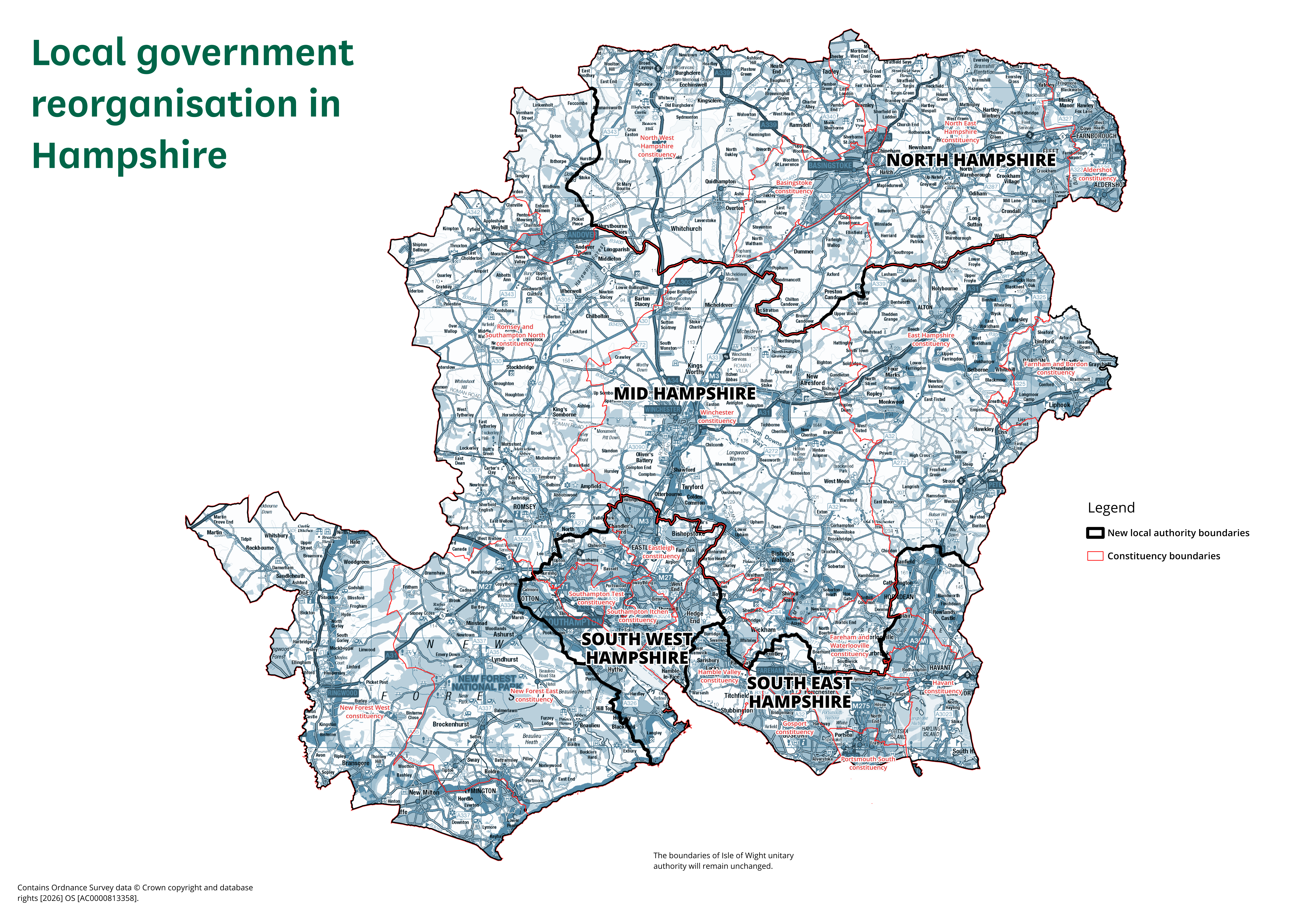
North Hampshire
Current areas: Basingstoke and Deane, Hart and Rushmoor.
Population estimate: approximately 402,000.
Provisional area checker
Check which proposed unitary council would serve your address from April 2028.
Postcode lookup
Your postcode is sent directly to the open postcodes.io service to identify its current district and parish. hants.online does not retain it.
Proposed authorities
Current areas: Basingstoke and Deane, Hart and Rushmoor.
Population estimate: approximately 402,000.
Current areas: Most of East Hampshire, New Forest, Test Valley and Winchester.
Population estimate: approximately 466,000.
Current areas: Eastleigh, Southampton and seven parish areas from New Forest and Test Valley.
Population estimate: approximately 487,000.
Current areas: Fareham, Gosport, Havant, Portsmouth and four parish areas from East Hampshire and Winchester.
Population estimate: approximately 566,000.
Population estimates are House of Commons Library mid-2024 estimates, not target sizes.
Official map
The map includes constituency boundaries as well as the proposed unitary areas. Open the full image to inspect local detail.
Open full-resolution map